
A self drive itinerary of the South Island, New Zealand – Part I…
As some would say, we were crossing the ‘ditch’ to New Zealand – a new country to explore. I’m surprised we hadn’t visited sooner with only a 3 hour flight from Sydney, New Zealand was in close reach & what a beautiful country to explore. It’s no word of a lie that New Zealand has been bumped up to my top 10 favourite places in the world. I’m not sure in which order New Zealand comes yet, but hopefully we can explore the north island to help make up my mind.

In my opinion, the South Island of New Zealand is best explored by driving as opposed to cruising or flying between cities – the scenery is just too stunning to miss. With 11 full days to explore, we opted for a campervan through hire company Britz for the true New Zealand experience.
Scoring cheap flights with my beloved Jetstar Airways, we were on our way to Christchurch International Airport. The cheap flights also meant weird departure and arrival times, landing into Christchurch at 1:00 am. Luckily, our amazing hotel Airport Gateway Motor Lodge had 24-hour shuttle, 24-hour check-in and the nicest staff we’ve ever come across – they made you feel at home!
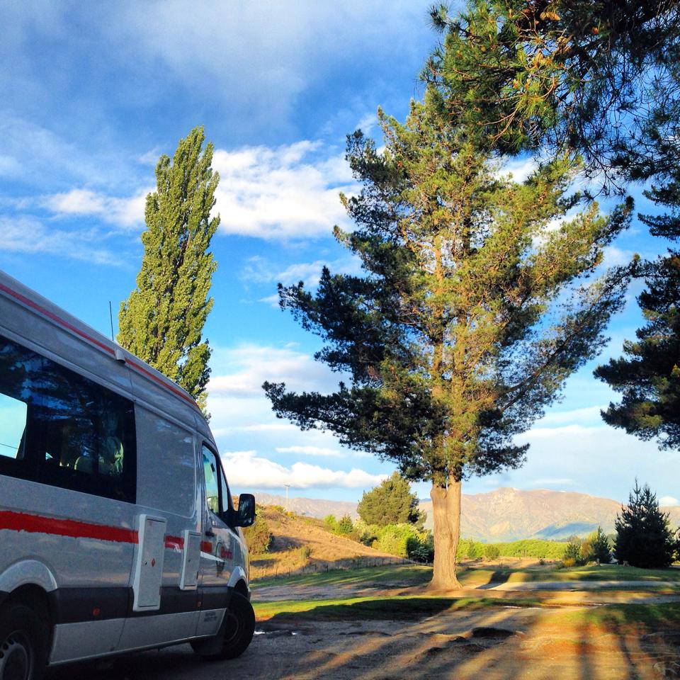
Into the camper! 7.3 metre long & 3 metre high, our new home for the next two weeks was perfect – double bed, gas cooker inside with microwave, kettle, toaster, gas BBQ, toilet, shower and a heater for those colder nights.
Christchurch to Kaikoura
Distance: 181 km – 2.5 hours – State Highway 1
Departing Christchurch, we were on our way north along the east coast. I jumped with excitement in my seat as the sun was shining and we passed rolling green hills, turquoise blue rivers and beautiful beaches.
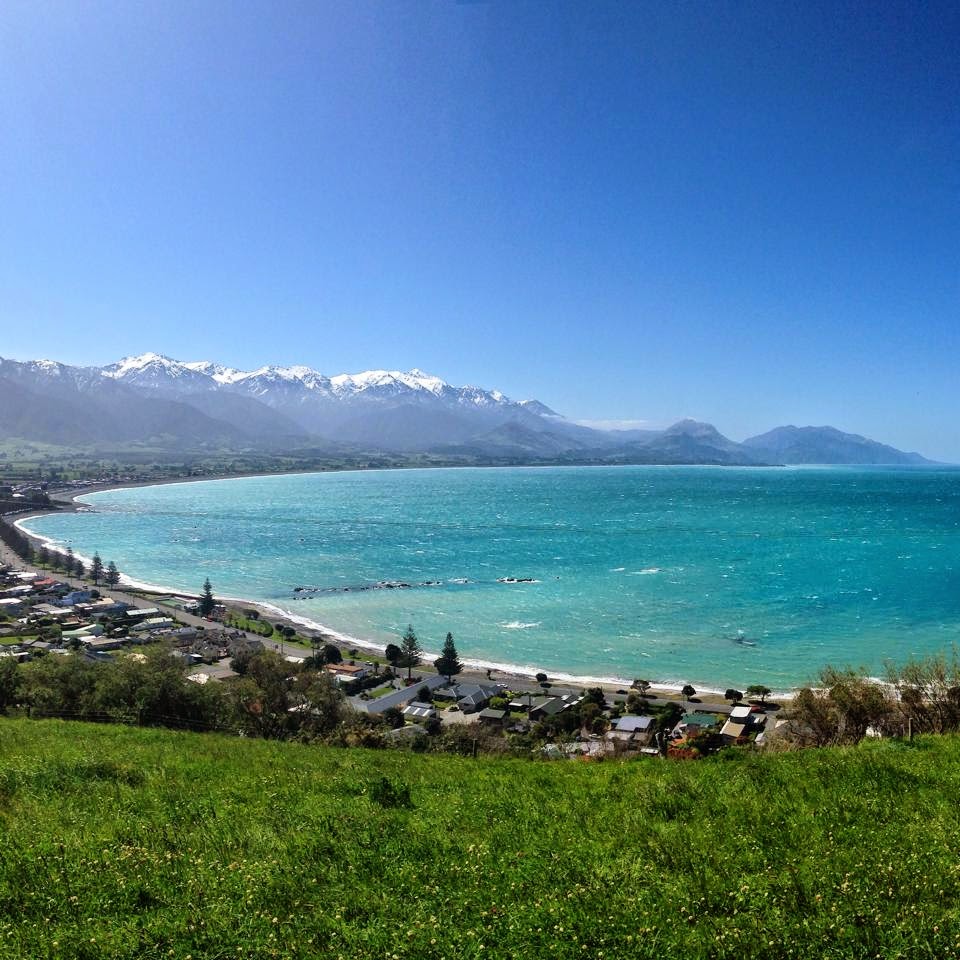
We arrived in the most underrated town; Kaikoura – This place isn’t talked about enough. Snowcapped mountains towered the beach-style town below. The ocean was such a beautiful blue & the lookout is a must to get the best perspective of the town. The wind was howling as we head to the oceans shore. Sleeping seals lazed around the rocks on the waters edge.

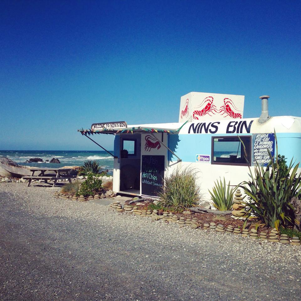
Approx. 25 minute drive north got us to the Lonely Planet recommendation Nins Bin; a retired caravan style shop catching and cooking up fresh seafood including the famous Crayfish! The wind got the better of us so we enjoyed our fresh cooked Crayfish in the camper.
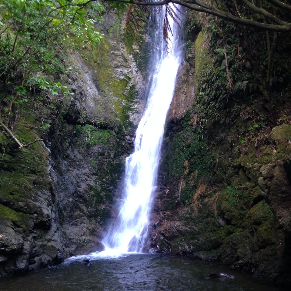
The local girl working told us about the Oahu Stream Walk – a 5 minute drive north to the left hand side of the road. It was here that she revealed seal pups would be playing under the waterfall. An easy 5 minute walk through the trees led us to the beautiful waterfall where we watched the seal pups swim & flip for over an hour.
Kaikoura to Blenheim
Distance: 128 km – 1.5 hours – State Highway 1
We arrived in Blenheim, gateway to the famous Marlborough Wine Region & our first sleep stop for the road trip. New Zealand were in their daylight savings time meaning days are longer as the sun shines high late into the evening. After checking into our camp site for the night, we walked to nearby restaurants recommended to us by the site manager. To our surprise, everything was dead shut! On the Saturday night! Fortunately for us (or not) KFC was still open down the road.
New Zealand wine, in particular their Sauvignon Blanc is very popular in Australia but maybe the Marlborough wine region lacked tourism or advertisement. Or maybe we weren’t in a busy time of year. Still, the wine tasting, the food & the views were amazing ! From most accommodation or information centres you should be able to pick yourself up a map of all the wineries in the region. We used this map to create our own self drive itinerary visiting wineries such as Rock Ferry, Hunters, Nautilus and last stop Wairau River Wines for one last wine taste and the most delicious lunch!
Camp Site: Top 10 Holiday Park, Blenheim
Price: $42 for two persons at a powered site

Blenheim to Abel Tasman National Park via Picton
Distance: 198 km – 3 hours – State Highway 6 & 60
NZ drivers are a lot more laid back than Australians as we navigated a 7.2 metre long campervan around the winding Queen Charlotte drive – drivers still patiently following behind & giving a toot as we pulled over to the left to let them pass. It was beautiful viewing the Queen Charlotte & Marlborough sounds from the road, but we weren’t exploring them by foot this time. We drove the coastal highway that runs along the top of the South Island visiting towns like Nelson & Mouteka, before heading half an hour further to Marahau where we would be based for the night. Although the drive from Mouteka to Marahau only takes half an hour, be prepared for more crazy sharp turns around the mountain to get there.
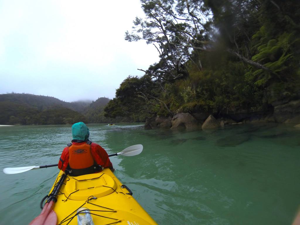
Waking up early, we head to our meeting spot for a full day of kayaking the beautiful Abel Tasman National Park with MSK kayaks. Our trip included a water taxi transfer north to the Tonga Reserve where we would explore before paddling the coastline back south with our guide.
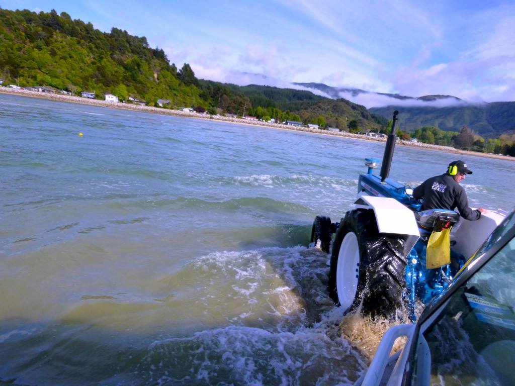
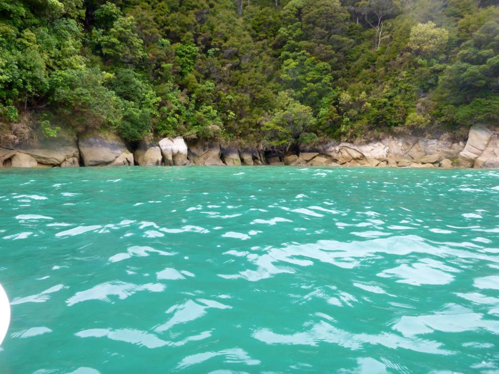
The tide was so low in the morning that we were told to jump on the boat, already loaded with kayaks, before being towed out by a tractor in the low tide. A sunny start to the morning showed just how beautiful the colours of the water are.
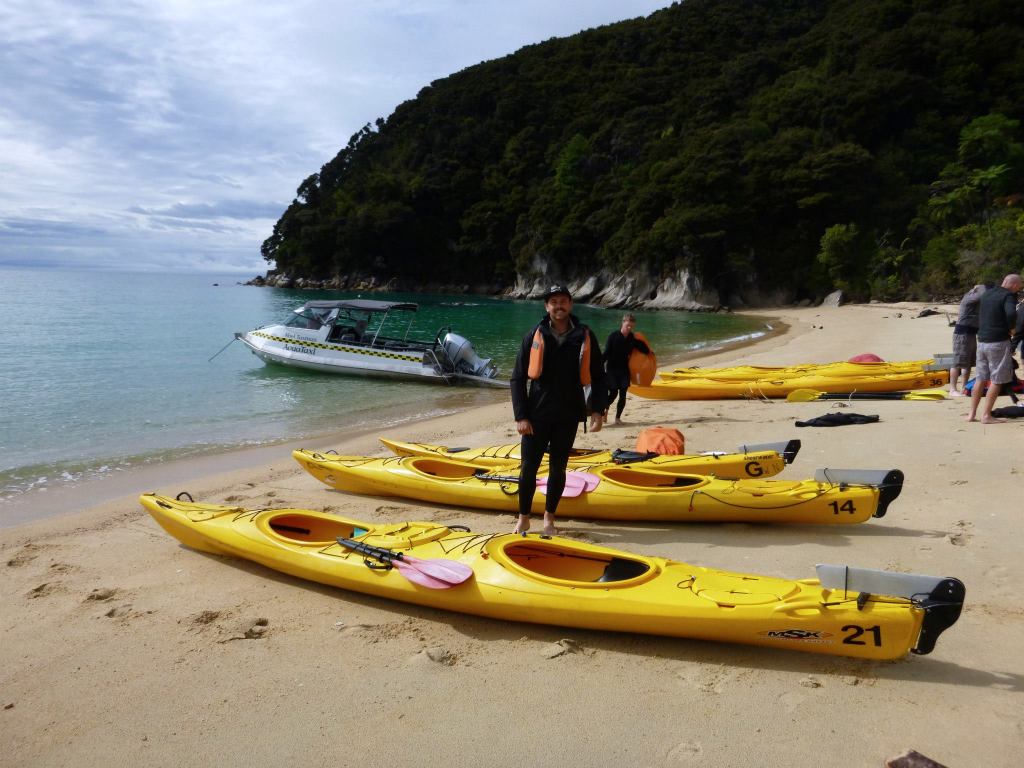

We arrived at Onetahuti bay to collect our kayaks and start our paddle.
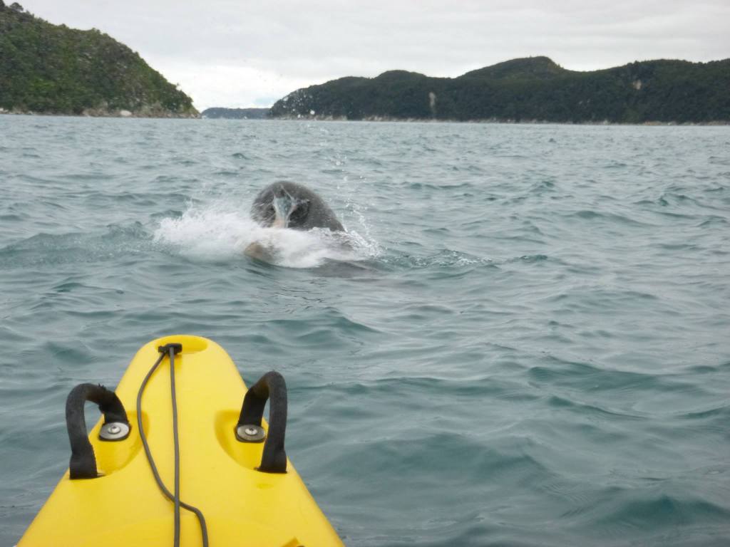
It wasn’t long before we saw our first seal, who had just caught a massive octopus. We watched the seal for ages as he flipped & slapped the octopus back and forth before finishing him off.

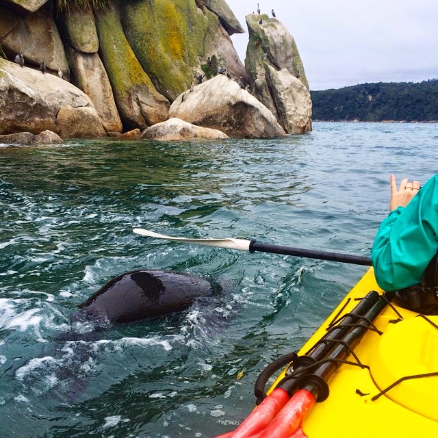
We headed one bay north to the beautiful shag harbour – turquoise green waters led us through boulders covered in sleeping seals sun baking, before reaching a beautiful stream & waterfall. Next was the paddle to Tonga Island, and there was no shortage of seals or shags!! Our guide explained how Tonga Island is the largest seal colony in the Abel Tasman as two male seals played & fought underneath my kayak.
We arrived at Mosquito bay for our lunch stop – thankfully not named because of the insects!! With lunch included, we enjoyed fresh sandwiches, muffins & warm coffee to help us heat up. It was almost perfect timing as we finished packing our picnic away and the weather turned. Not necessarily for the worst as we got to experience the best of both as it started to rain and the swell picked up.
It may not look it on a map, but the paddle between each bay is further than it may seem especially when the swell makes it more of a challenge. Heading into Bark Bay was fun as the waves picked up our kayak and helped us paddle in faster. However my first question was, do we have to paddle back out ? We explored the beautiful calm bay that was sheltered by the storm, kayaking up stream where we viewed the swing bridge & waterfall which can be passed on one of the Abel Tasman Walking Tracks.
The answer to my above question was yes. Our mission was to kayak out over stormy 1.5 metre crashing waves into deep sea, avoiding the coast line so we weren’t picked up and swept into the rocks.
Frenchman Bay was the next bay we explored. The rain made the water calm. This was the most peaceful part of the trip as the only noise that filled our ears was the light rain & the sound of our kayaks pushing through the water. Getting back out of the bay was the hardest part as the waves were well and truly in full force as we paddled as hard as we could. Safe to say we were happy to hit the shore from our extremely tiring but rewarding paddle. Our last bay for the day was Anchorage where the water taxi picked us up for our drive back to Marahau.
After thanking our amazing guide for such an adventurous day & saying bye to our German friends we showered and decided to head back to the previous town Motueka. We booked a powered site for the night, looking forward to dinner and a good nights sleep. We had dinner at Sprig & Fern Motueka where they served the most amazing steak with locally brewed beers on a tasting tray – perfect ending to the day.
Camp Site: Marahau Beach Camp, Marahau
Price: $35 for two persons at a powered site
Camp Site: Fernwood Holiday Park, Motueka
Price: $40 for two persons at a powered site

Abel Tasman National Park to Franz Josef via Punakaiki
Distance: 485 km – 5 hours 50 minutes – State Highway 6
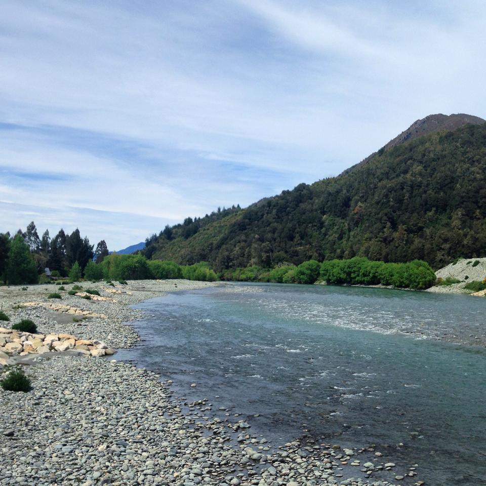
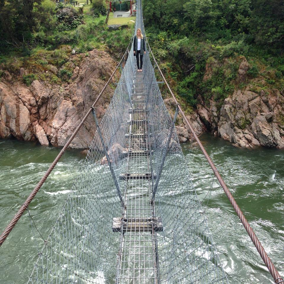
You could say there’s not much to ‘see & do’ on the drive towards the west coast, except for the beautiful landscapes that passed our windows – exactly what I love! It’s true with New Zealand that the destinations may look closer on a map but chances are you’re driving around amazingly winding mountains at 25km/h. We stopped along the road to check out the clear Buller river before stopping in to explore the old mining town & suspension bridge.
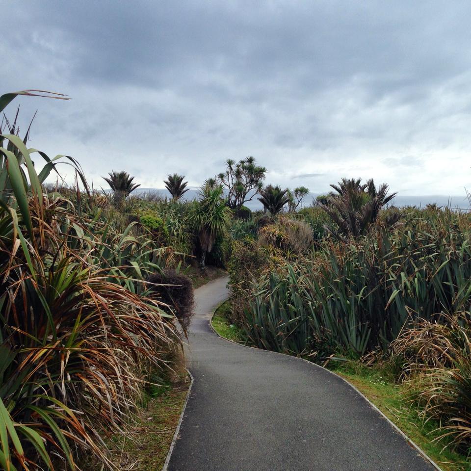
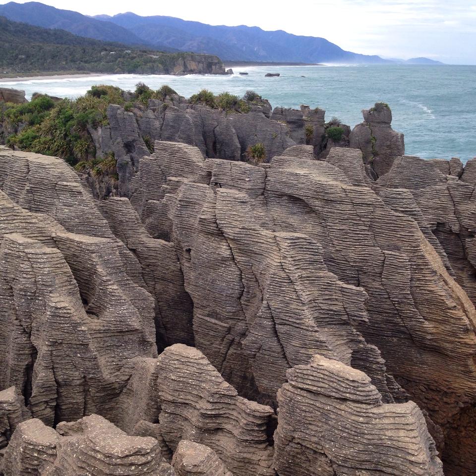
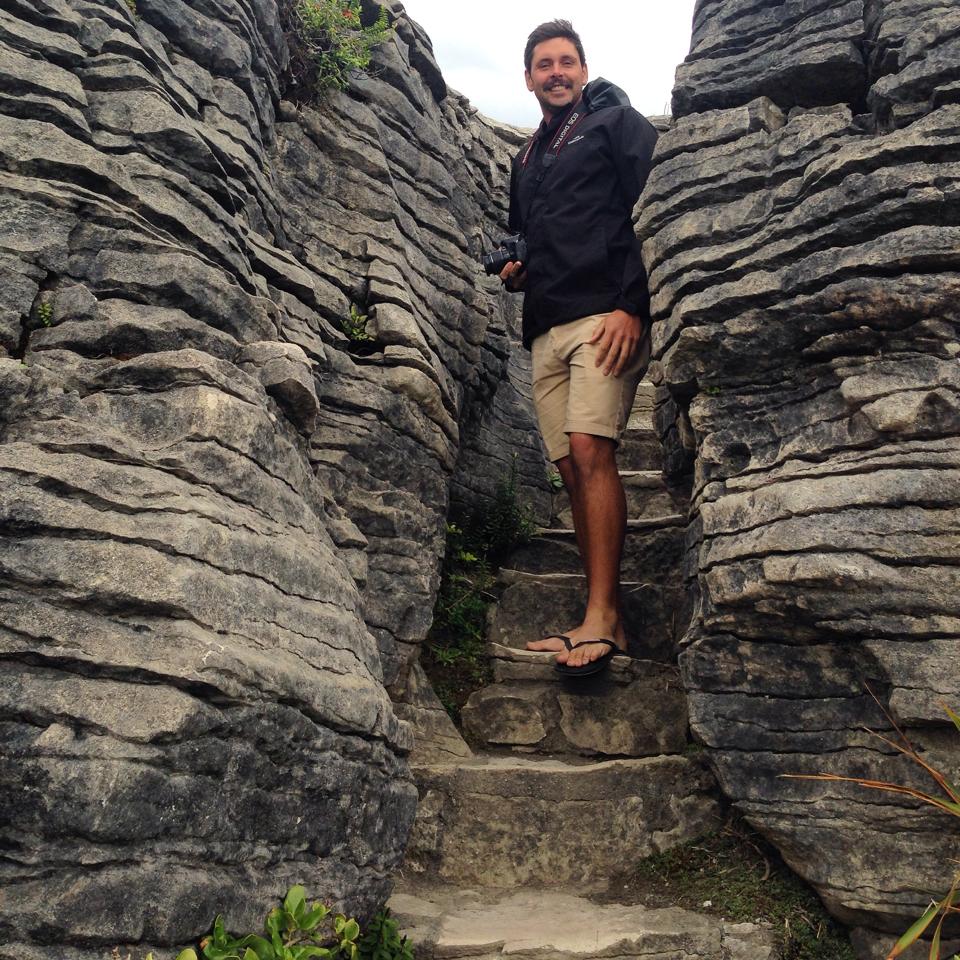
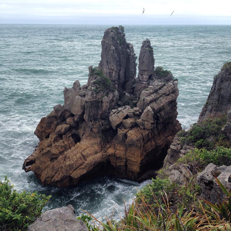
We had finally reached the beautiful west coast, reminding us more of Hawaii with it’s tropical outlook and crashing coastline. We arrived at Punakaiki, otherwise known as the pancake rocks. Great little walk to stretch the legs and check out the scenery. There’s also a blow hole but we hadn’t arrived at the right time of day for that.
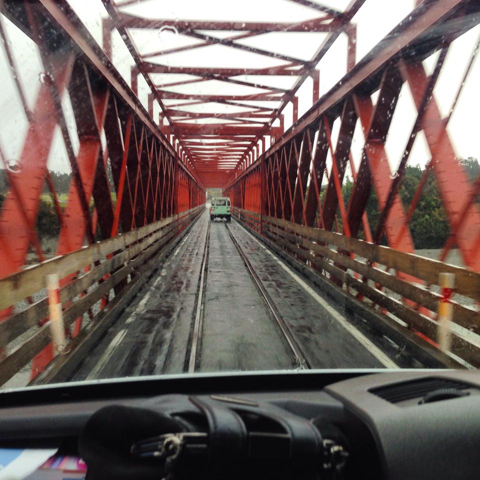
Whilst driving around NZ, you may notice that almost every bridge you cross is one-way. Meaning cars have to give way to each other allowing only one car on the bridge at a time. The bridges aren’t always short in length either but luckily traffic is minimal. This particular one-way bridge also had train tracks which we didn’t realise until on the bridge! Luckily no trains in sight.
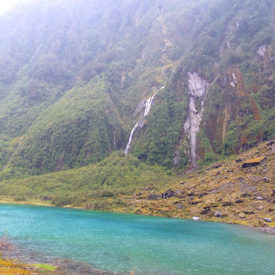
With a quick pit stop in Greymouth, the largest town on the west coast, we decided to continue on the 2 hour drive to Franz Josef. The rain had set in and the area resembled more a rainforest than it did a glacier town. The forecast wasn’t looking good for the Heli Hike we were hoping to book to explore the Franz Josef Glacier. After checking in to the camp site, we crossed the road to the Glacier Hot Pools where entry was $25 per adult but we were a little disappointed as they felt more like heated swimming pools than natural heated spring pools like the name would suggest.
Morning greeted us with more low cloud cover so heli hiking was off the menu. We visited the West Coast Wildlife Centre so we could see the Kiwi bird before driving to Franz Josef Glacier car park, hoping to head on one of the walking tracks however the rain started to pour…
Camp Site: Glacier Country Campervan Park, Franz Josef
Price: Unsure

Franz Josef to Albert Town
Distance: 279 km – 3 hours 15 minutes – State Highway 6
NZ; in particular Queenstown is known as the adventure capital – even birds are dare devils in NZ as they fly in front of the car driving 100km’s only just escaping from being hit.
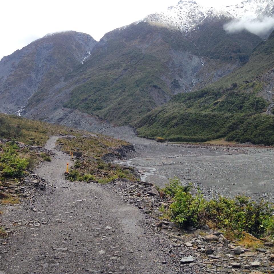
We stopped in at the next known glacier; Fox Glacier. The drive is beautiful as you pass rainforest terrain before reaching glacier blue waters and the car park at the foot of the glacier. We headed on the Fox Glacier valley walk, a quick 15 minute return loop.
Continuing on south, we followed the Haast Pass heading for Queenstown. We stopped in the Hard Antler restaurant for a break, a drink and to taste the famous west coast white bait patties – delicious!
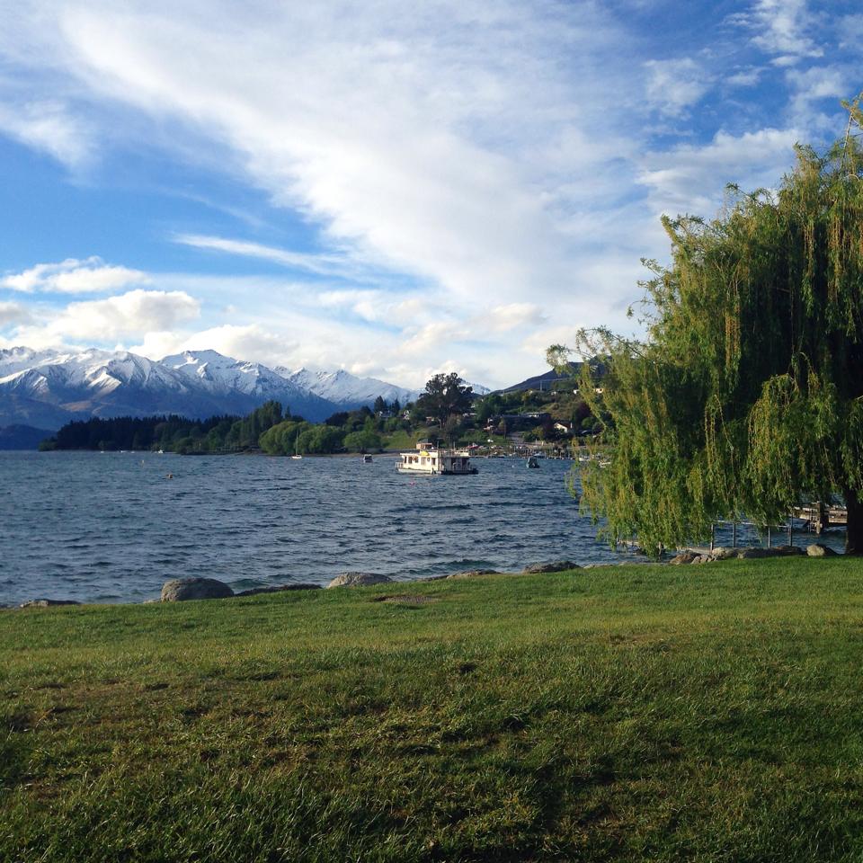
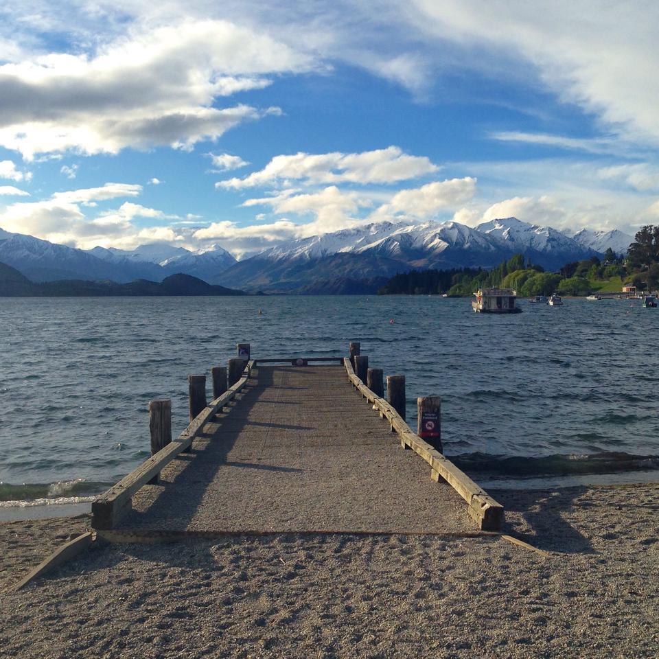
First site of Lake Wanaka is absolutely gorgeous! The colour of the water doesn’t get much better with large green mountains towering above – good scenery is an endless supply in NZ. Passing Lake Hawea, stopping to take photos, we then arrived in the beautiful town of Wanaka. Can I move here? Stunning lake setting with snow capped mountains in the portrait. Quaint streets with that alpine feel I love!
We spent the night at a beautiful camping ground in Albert Town located right on the river – serenity!
Camp Site: Albert Town Camping Ground, Albert Town
Price: $7 pp for a non-powered site

Read on for part II where we head to Queenstown and beyond.
